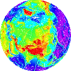
 Let's look at the dimensions and variables from the netCDF file
elevations.nc:


 Let's look at the dimensions and variables from the netCDF file
elevations.nc:
ncdump -c elevations.nc
netcdf elev1 {
dimensions:
	lat = 180 ;
	lon = 360 ;
variables:
	float lat(lat) ;
		lat:standard_name = "latitude" ;
		lat:units = "degrees_north" ;
	float lon(lon) ;
		lon:standard_name = "longitude" ;
		lon:units = "degrees_east" ;
	short elev(lat, lon) ;
		elev:standard_name = "height" ;
		elev:missing_value = 32767s ;
		elev:units = "meter" ;

// global attributes:
		:title = "Surface elevations" ;
data:

 lat = 89.5, 88.5, 87.5, 86.5, 85.5, 84.5, 83.5, 82.5, 81.5, 80.5, 79.5,
...
    -88.5, -89.5 ;

 lon = 0.5, 1.5, 2.5, 3.5, 4.5, 5.5, 6.5, 7.5, 8.5, 9.5, 10.5, 11.5, 12.5,
...
    358.5, 359.5 ;
}
lat and lon
represent latitudes and longitudes, respectively.lat and lon are
examples of coordinate variables
representing the coordinate values along the lat and
lon dimensions.