- To: "awips2-users@xxxxxxxxxxxxxxxx" <awips2-users@xxxxxxxxxxxxxxxx>
- Subject: [awips2-users] Strange Issue with Streamlines in CAVE/NCP
- From: Brian Bernard <brian.brianbernard@xxxxxxxxx>
- Date: Tue, 4 Nov 2014 14:41:05 -0500
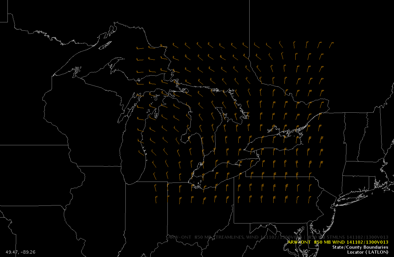
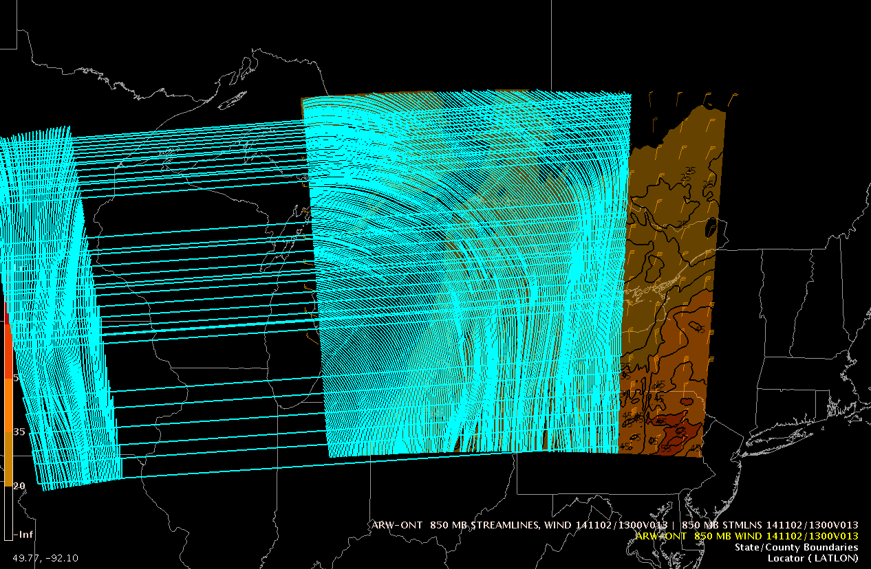
While using the CAVE/NCP perspective I've come across a rather strange
problem. When plotting barbs or isotachs the plot is normal. However, when
I plot streamlines the contours are shifted to the west and stretched into
Minnesota and Iowa, when my WRF-ARW domain ends at the eastern shore of
Lake Erie. Enclosed are two screen captures to illustrate the problem.

Brian Bernard
Attachment:
850_wind_barbs.png
Description: PNG image
Attachment:
850_streamlines.png
Description: PNG image
- Follow-Ups:
- Re: [awips2-users] Strange Issue with Streamlines in CAVE/NCP
- From: Michael James
- Re: [awips2-users] Strange Issue with Streamlines in CAVE/NCP
- From: Brian Bernard
- Re: [awips2-users] Strange Issue with Streamlines in CAVE/NCP