- To: idvusers@xxxxxxxxxxxxxxxx
- Subject: [idvusers] Is an update of world country outlines available?
- From: Heiko Klein <Heiko.Klein@xxxxxx>
- Date: Mon, 03 Aug 2009 14:29:48 +0200
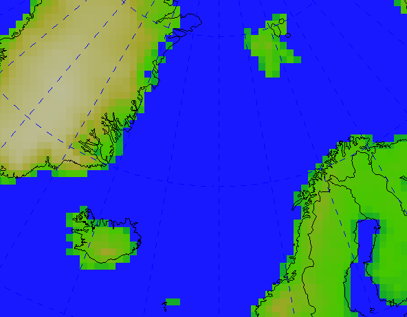
I've been checking some altitude maps over Europe and got a bit confused
by using the default IDV (2.7u1) 'world country outlines'. It seems like
Iceland (lower left corner) is about 2 degrees more west than the
altitude, while Svalbard/Spitsbergen (upper right corner on the attached
figure) has only 5% of its actual size.
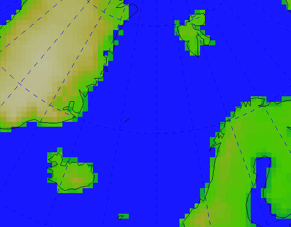
The same map looks okay with the World Coastlines, which is of lower resolution.
I recognized, too, that the country borders don't reflect the split of serbia and montenegro in 2006.
Does somebody have other country border or higher resolution world coastline files available? Did somebody convert i.e. the recently updated NCL / Ncar graphics database 'Earth..4' to an idv-readable file?
Best regards,

Heiko
- Follow-Ups:
- Re: [idvusers] Is an update of world country outlines available?
- From: Don Murray
- Re: [idvusers] Is an update of world country outlines available?