- To: netcdfgroup@xxxxxxxxxxxxxxxx
- Subject: [netcdfgroup] project raster from user-defined projection to "GCS_WGS_1984"
- From: June Yeung <jyeung@xxxxxxxxxxxxx>
- Date: Mon, 09 Jun 2008 12:42:17 -0400
Hi, I am trying to project a raster in ArcMap from a user-defined
projection to GCS_WGS_1984, but I am having problems and I was wondering
whether anyone can help?
__My rainfall data come from the U.S. national radar network (NEXRAD), and the projection is not one that is available in ArcMap but instead, it is a projection known as HRAP (the standard projection for radar-rainfall products). Ultimately, I need the projection to be “GCS_WGS_1984”. When I try to use the “projections and transformations” tool to project the raster, all the rainfall data are gone (will not show up in ArcMap and when viewing a netCDF file using ncdump, the file does not contain any rainfall values—please see below). Has anyone encountered this problem and, if so, could you please provide advice on how this can be overcome?
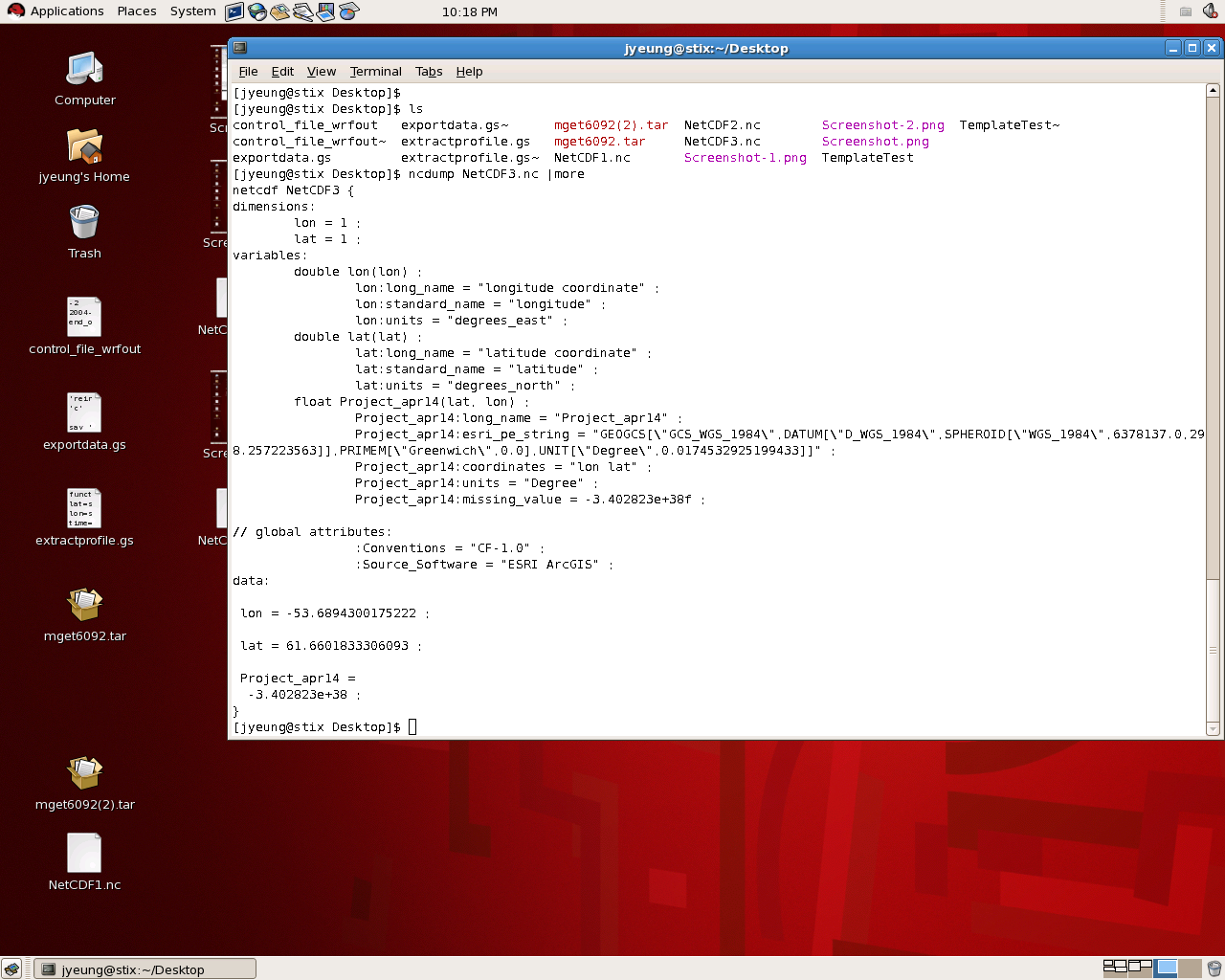
_MORE DETAILS_
Two screenshots are attached.
Figure 1 is what I get when I project a raster from the HRAP coordinate (user-defined) to the GCS_WGS_1984 and then export the file as a netCDF format. Note that there are no rainfall values. (The variable “Project_apr14” is rainfall)
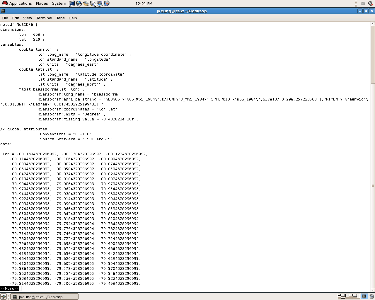
Figure 2 shows what a correct netCDF file should look like (this is a different file). Note that the file is very large and contains rainfall values. (The variable “biassocrsm” is rainfall) These data could be correctly projected because the original raster was already in GCS_WGS_1984 and, therefore, did not require reprojection in ArcMap.
Any help would be appreciated! Thank you very much for your time and attention.
My best,
June

P.S. I would like to thank everyone who replied to my question about how to
convert a raster to netCDF format. I was able to do so in batch mode using the
multidimensional toolbox in ArcMapV9.2. Thanks!

--
June Yeung, PH.D. Candidate
Department of Civil and Environmental Engineering
Environmental Engineering and Water Resources Program
Princeton University

Office: Equad E-223 (609-258-4727)
Lab: Equad C-329 (609-258-6383) Mobile: 609-423-5338