Hi John, all,
Sorry for joining this late. WMS doesn't "support" irregular source data grids
because it doesn't really have to. It's up to the server to decide how to
produce an image (which is usually a regular grid in some defined CRS) based on
the source data. The WMS capabilities document doesn't describe the source
grid in great detail and the horizontal gridding scheme is not advertised in
the WMS Capabilities doc.
ncWMS (and hence THREDDS-WMS) uses a simple nearest-neighbour scheme for
regridding, which seems fine for producing images (at least, no-one has ever
complained!) but may not be appropriate for serving data, depending on what you
want to do.
However, if THREDDS wants a means to serve resampled data through WCS, the WMS
libraries should make this pretty easy to implement. But the user must be
aware that the data have been processed at the server side.*
We would also need to implement GeoTIFF output for your needs... probably there
is code out there to do this already.
Hope this helps,
Jon
[* Aside: in my view, the WCS interface is most useful for GIS users, who are
much less likely to care about how data are regridded than scientific users;
scientific users can use OPeNDAP to get the "raw" data of course. Perhaps in
most cases, GIS users just need a "WMS for data" rather than a full-fledged
scientific data server. But I don't know how THREDDS-WCS is used in the wild.]
From: John Maurer [mailto:jmaurer@xxxxxxxxxx]
Sent: 16 June 2011 02:47
To: THREDDS Users
Cc: Jon Blower
Subject: Re: [thredds] future TDS WCS support for irregular/curvilinear grids?
Thanks, Ben! Sounds good! Glad to hear things are progressing along these
lines. Sounds like it could be quite some time, though, before irregular grids
are formally adopted by the international standards community and trickle down
to all of us here in TDS-land. This is why I was hoping Unidata could maybe
short circuit this process by regridding the data onto a regular grid via the
TDS backend and then serving it out through WCS (1.0) that way. But that is
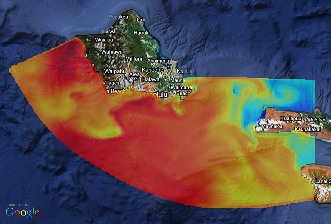
maybe asking (way) too much. Again, ncWMS is presumably doing something similar
to provide WMS for irregular grids (see attached image)? Or is the WMS spec
ahead of WCS in terms of its adoption of irregular grids? Perhaps Jon Blower
could elucidate (cc'd)...
[sst_roms_curvilinear.png]
Cheers,
John Maurer
On Wed, Jun 15, 2011 at 3:25 PM, Ben Domenico
<Ben@xxxxxxxxxxxxxxxx<mailto:Ben@xxxxxxxxxxxxxxxx>> wrote:
Hi John et al.,
I am currently at the OGC Technical Committee meetings so your note is quite
timely. My concept of how this sort of capability might be worked into the
standards -- from the netCDF point of view anyway -- is via the CF conventions.
We are currently working on a CF extension for the OGC netCDF core standard.
At the same time we are working on a CF-netCDF encoding standard for WCS 2.0.
But my understanding is that irregular/curvilinear grids are not formally
adopted yet as part of the CF conventions. When these grids officially become
part of CF, we can then do a revised extension to CF-netCDF and to WCS.
Please correct me if I'm wrong about the status of irregular/curvilinear grids
in CF. If you have suggestions for better ways to accomplish this, let me
know. But for now this is the general outline of the plan for getting this
into the formal standards world.
For what it's worth.
-- Ben
On Wed, Jun 15, 2011 at 6:23 PM, John Maurer
<jmaurer@xxxxxxxxxx<mailto:jmaurer@xxxxxxxxxx>> wrote:
Thanks for the explanation, Ethan. If TDS could handle the regridding itself,
then it could work. I assume this is what's happening on the backend via
TDS/ncWMS for GetMap requests since the WMS spec doesn't handle
irregular/curvilinear grids either (right?). I was hoping a future enhancement
could someday do the same for TDS WCS. Something for the suggestion box.
Cheers,
John
On Wed, Jun 15, 2011 at 2:17 PM, Ethan Davis
<edavis@xxxxxxxxxxxxxxxx<mailto:edavis@xxxxxxxxxxxxxxxx>> wrote:
Hi John,
TDS currently only supports WCS 1.0.0. The WCS 1.0.0 specification
itself does not support requesting or returning irregular/curvilinear
grids. I believe the same is true for WCS 1.1.0.
I don't belive this is necessarily the case for WCS 2.0. However, the
2.0 specification is written in the new core/extensions paradigm and I
don't believe the extensions necessary to request or return
irregular/curvilinear grids are yet written.
The TDS WCS implementation does not currently support regridding data.
So, currently one gets the data from the WCS in the same projection in
which the data is stored. The combination means the TDS WCS can only
serve regularly gridded data.
Ethan
On 6/15/2011 5:31 PM, John Maurer wrote:
> Hi All,
> We now use the WCS service through TDS to serve GeoTIFF files to users.
> Since it only works for regular grids, I was wondering if TDS could be
> enhanced in the future to support irregular/curvilinear grids via WCS?
> TDS/ncWMS already handles curvilinear grids via WMS, so I was hoping the
> same sort of intervening magic could be applied for TDS' WCS service?
> Thoughts?
> Thanks for listening!,
> John Maurer
> Pacific Islands Ocean Observing System (PacIOOS)
> University of Hawaii at Manoa
_______________________________________________
thredds mailing list
thredds@xxxxxxxxxxxxxxxx<mailto:thredds@xxxxxxxxxxxxxxxx>
For list information or to unsubscribe, visit:
http://www.unidata.ucar.edu/mailing_lists/
_______________________________________________
thredds mailing list
thredds@xxxxxxxxxxxxxxxx<mailto:thredds@xxxxxxxxxxxxxxxx>
For list information or to unsubscribe, visit:
http://www.unidata.ucar.edu/mailing_lists/