Please check 5.11 Converting Between 0-to-360º and -180-to-180º Grids in IDV
<http://marinedataliteracy.org/grids/idv_180_360.htm> which might do the
job.
From: thredds-bounces@xxxxxxxxxxxxxxxx
[mailto:thredds-bounces@xxxxxxxxxxxxxxxx] On Behalf Of Jolibois Tony
Sent: Thursday, September 18, 2014 5:19 AM
To: thredds@xxxxxxxxxxxxxxxx
Subject: [thredds] NCSS : request that subset data across 180° longitude
Dear all,
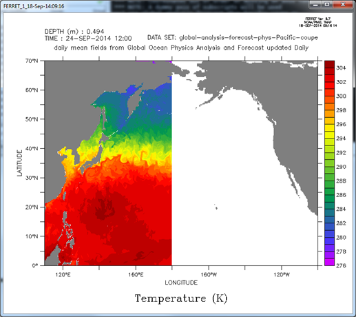
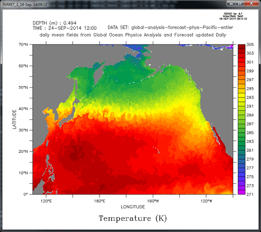
I have a dataset with a global spatial coverage (longitude=-180/179.916;
latitude=-90/90) served by the netCDF subset service of Thredds.
If I request data on Pacific ocean, for example longitude=110/260;
latitude=0/70, the subset service gives me a file covering 110/179.916, and
not 110/260 (data cut at the end of longitude dimension).
Do you confirm this behavior ? Do I miss something ? If confirmed, it means
that to fulfill the need the user shall make 2 requests and concatenate ?
Best regards,
Tony
Tony Jolibois
C.L.S.
Direction Océanographie Spatiale
Parc Technologique du Canal
8-10, rue Hermès
31520 Ramonville St-Agne, FRANCE
Tel: +33 (0)5 61 39 37 97 Fax: +33 (0)5 61 39 37 82