Hello All,
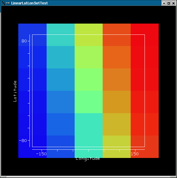
I'm trying to employ the LinearLatLonSet to take advantage of the
longitude "wrapping". Can someone provide me an example of how to
properly use this? Although I can get an image, it's not clear to me
that any interpolation is occurring across the longitude boundary. Test
case is based on example P3_2 in the tutorial and salient parts of the
code are listed below.
    int NCOLS = 5;
    int NROWS = 6;

    latitude = RealType.Latitude;
    longitude = RealType.Longitude;
    domain_tuple = new RealTupleType(latitude, longitude);

    domain_set = new LinearLatLonSet(domain_tuple, -90.0, 90.0, NROWS,
                                               -180, 180.0, NCOLS);


Thanks for your help!

-- john

====================================================
John Cartwright
Associate Scientist
Geospatial Data Services Group
CIRES, National Geophysical Data Center/NOAA
(303) 497-6284
John.C.Cartwright@xxxxxxxx
====================================================